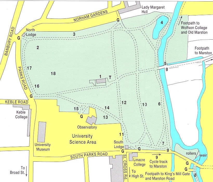
Here is a map relating to the ‘Mesopotamia” walk and “Dames Delight” bathing place that Gwen Archer and her boys used to frequent, in the late 1940s. See the adjoining graphic entitled “A golden country” (1948), and its accompanying text. This map really shows the University Parks, and the adjacent roads such as South Parks Road, and Banbury Road (where WGRA Archer, my paternal grandpa, lived at No.130 from about 1925 to about 1959, at about at least half-a-mile north of here). But the map does show, in the bottom RH corner the River Cherwell (coloured blue), in all its multifarious branches, including (marked by a reference No.8) the “Mesopotamia” part in which it is ‘divided in twain’ in biblical fashion. And the map shows (likewise at the bottom RH corner) the weir (identified as such) at “Dames Delight” (though that name does not appear because the bathing place had been dismantled by the time this map was made), and the map shows the rollers (indicated by a single black line near the “weir”) where punts cross between the upper (undivided) branch of the Cherwell (near Parsons Pleasure) and the lower (divided) branch below the “Dames Delight” weir. To go to the graphic showing that area in its current form please click here.